Digital Twin platform for sustainable cities

Digital twins for better urban decision-making
The path to sustainable cities is paved with obstacles and uncertainties. How do you choose the best scenario? What is the impact of spatial interventions? How can you encourage more effective citizen participation? GIM’s digital twin platform, Belmap DT, clearly visualizes policy options and supports better-informed decisions.

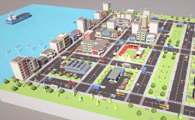
Better understanding the real world through a digital twin
Simulate, analyze, decide
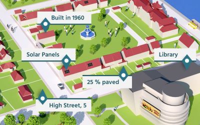
Belmap DT processes spatial data from Belmap and other sources. This input forms the basis for advanced simulations and analyses for urban planning, climate adaptation, and environmental analysis. The platform is designed to be open and interoperable, allowing users to import additional data.
Powered by Belmap
Clear visualization for better participation
|
Citizen participation and collective decision-making are often challenging processes. With 3D visualization in Belmap DT, you bring modeling to life in real time and can simulate the possible effects of interventions on the ground. That’s why Belmap DT is an indispensable tool for urban policymakers and city planners to facilitate public consultations and collective decision-making processes.
|