Every location has a story. We bring it to life.
Turning complexity into clarity, we unlock the power of maps and seamlessly connect software, data, and services. Together we shape intelligent networks and safer streets, empowering greener, smarter, and more resilient communities every single day.
More about Merkator Group


Clarity amid complexity: geodata as a compass for the future

Global impact: building sustainable and smart communities together

Our markets
At Merkator Group, we bring innovation and precision to a diverse range of markets. Whether shaping smart cities, strengthening critical infrastructure for utilities and telecom, or driving digital transformation in the private sector, we provide the expertise and tools to move progress forward.

Energy & Water
At Merkator Geo Utility Services, we develop intelligent Geo-IT systems for geospatial workflows that are essential for telecom, utilities, network design, asset inventory, and seamless data sharing with public authorities.

Telecom
By combining physical and logical network data, a complete overview of the network emerges. This enables telecom companies to work more efficiently and prepare their infrastructure for the future.

Governments
With innovative technology and geospatial data, cities become more intelligently connected, mobility is improved, and safety is enhanced.

Private sector
The private sector, exemplified by the banking and insurance industries, drives innovation and economic growth by developing products and services that respond to market needs.

Global vision, local transformation
From our strategically chosen hubs in Belgium, the Netherlands, Spain, France, and the Middle East, we support clients around the world. With local expertise and global reach, we deliver the same high standards of quality and service everywhere.

Belgium
Merkator’s headquarters are located in Zellik, Belgium, with additional offices in Ghent, Leuven, Diegem, and Gembloux. From these locations, we provide geospatial solutions for a wide range of sectors.

Netherlands
Merkator operates in the Netherlands with offices in Zaltbommel and Groningen, supporting organizations with geospatial expertise and innovative network solutions.

Spain
Merkator has an office in Oviedo, in the Spanish region of Asturias, from where it provides geospatial solutions for the Iberian market.

Middle East
From its office in Dubai, Merkator supports clients in the Middle East with geospatial expertise and innovative solutions for complex networks.
Merkator Software
Our software makes it easy to manage, visualize, and analyze infrastructure data. From real-time network management and precise mapping to specification checks and digital network design, everything revolves around up-to-date data, streamlined workflows, and future-proof networks. Our software is also used by governments and truly makes a difference in the field.

Eaglebe Voor steden, gemeenten en politiezones.
Eaglebe connects cities, citizens, and public spaces. Smart permitting with minimal disruption. Always connected.
More about Eaglebe
Esri and VertiGIS Expertise
Within the Merkator Group, you’ll find Belgium’s largest Esri competence center. Since April 2025, SIGGIS has strengthened our rapidly growing geospatial ecosystem.
For over 20 years, our consultants have tracked and implemented every trend and innovation within the powerful Esri Inc. and VertiGIS suites—bringing the latest solutions to our clients time and again.

Esri
Esri is the global leader in GIS technology, offering powerful solutions for managing and analyzing spatial data.
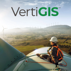
Vertigis
VertiGIS is a leading provider of geospatial software solutions, helping organizations make the most of their spatial data.
Geo Services
At Merkator Geo Services, we help network operators, energy, and water companies manage their infrastructure safely, reliably, and with an eye to the future. By combining deep GIS expertise with years of experience in the utilities sector, we provide a clear overview of all your assets—both above and below ground. This means every decision is better informed, every intervention is safer, and every investment is smarter.

We map network assets with precision, enabling better planning of design, deployment, and maintenance so your network remains robust and reliable for your customers.
We ensure the secure access to geospatial data with clear access rights and regulatory compliance, so that only authorized personnel can view critical information.
We improve data quality through smart checks and data models, making errors and gaps visible so that everyone works with a single source of truth.
We automate validations and routine tasks, check data against business rules, and shorten turnaround times, giving teams more time for complex analysis and innovation. Yes, AI is our partner in this – today.
More about Geo Services
We transform geospatial complexity into clear, sustainable solutions that make a difference today and help set the standards of tomorrow. It’s something we’re truly proud of.


Insights
Always on the move! Our world never stands still and neither do you. Read our latest updates here.
Read more